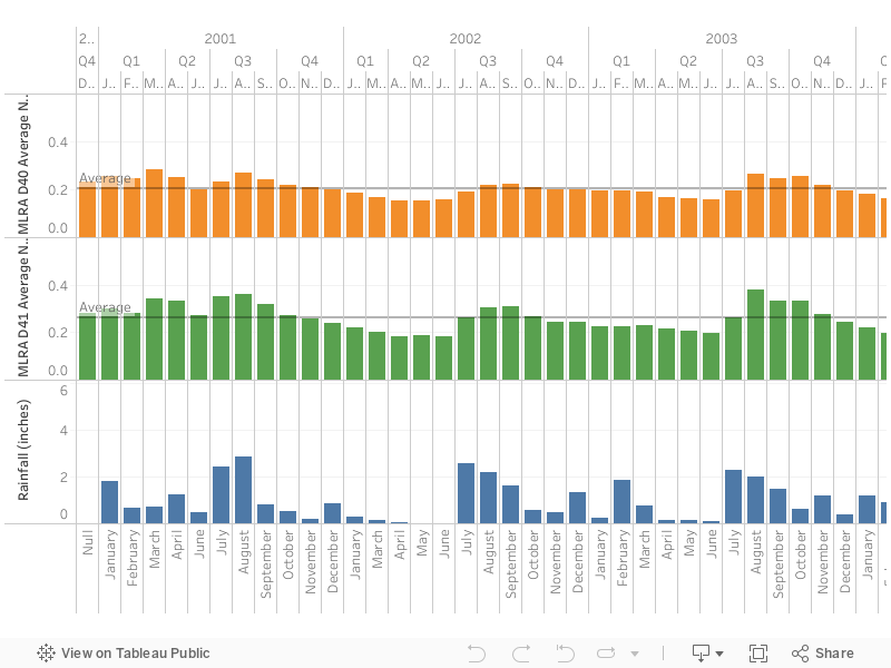
Altar Valley NDVI 16 day time series by Major Land Resource Area (MLRA) from 2002-2022
data derived from MODIS terra satellite (MOD13A2.061)
data derived from MODIS terra satellite (MOD13A2.061)
Didan, K.. MOD13A2 MODIS/Terra Vegetation Indices 16-Day L3 Global 1km SIN Grid V006. 2015, distributed by NASA EOSDIS Land Processes DAAC, https://doi.org/10.5067/MODIS/MOD13A2.006. Accessed 2022-04-20.
The map below responds to a mouse-digitized rectangle, polygon, or point with a line graph of the average NDVI for that input. The graph can be expanded and allows downloading of the NDVI data. Note that this is using MODIS data at 1-km spatial resolution, so areas selected of less that one sq-km will return an error.
Source: Altar Valley Conservation Alliance